
The Man Behind the Map
“A quality trail map image reflects a quality ski experience.”
We recently just met Jim Niehues, but we've really known him for as long as we've been skiing. Growing up, we spent countless hours pouring over the trail map in the lodge and heading up the lift at our favorite Vermont mountains like Sugarbush and Jay Peak. We collect them as souvenirs to remind us of great days on the mountain and cherish them as one of the few analog traditions in an increasingly digital world. Turns out, Jim has been with us the whole time.
If you've skied a major North American resort and looked at their trail map to plot your next run, then chances are you know Jim well too. He's been the man behind the map, painting over 300 resort maps from all over the world.
Alps & Meters: Who are you and what do you do?
Jim Niehues: I was raised on a farm in Loma, Colorado, and when we got a break, we would enjoy the surrounding environments of the canyons and mountains. The outdoors were truly a relaxing retreat, fishing, hunting or just exploring and taking in the scenery. This introduction to, and appreciation of, dynamic scenery has never wavered and is a huge part of why I pursued the career that I did. I am James Niehues, Ski Map painter.
“A trout breaks the water, hitting my fly far behind the boat and suddenly I am taken out of my daydream of painting the scene before me.”
What drew you to the mountains as a boy?
While trolling for trout with my dad and uncle I would gaze at the surrounding cliffs or the early morning mist rising from the water as the sun rose. I drew and painted at an early age and was inspired by the incredible beauty that surrounded me in Colorado. A trout breaks the water, hitting my fly far behind the boat and suddenly I am taken out of my daydream of painting the scene before me.
How did you get into painting maps?
Life took me in other directions just to make a living. I worked in print shops, an art department in an after-market automotive instrumentation company, a partner in an ad agency, and on to producing charts and diagrams for court room presentations. I looked up Bill Brown the ski map artist at that time. I was now 40, again painting scenery, and this time I would make a decent living at it.
“I continued working my regular job during the day, but in the wee hours I would get up at 3am and paint ski mountains”
Learning from Bill, and visiting Hal Sheldon's studio I starting to understand the process that was involved. They helped me to understand the actually painting process and why they worked with watercolors. I painted my early landscapes in oils, and watercolor was intimidating.
My first illustration, which was a commission given to Bill, took me an entire month to get used to this new technique and get the values right. I wanted it to be as much like a Bill Brown painting as I could make it. He presented it to client as if he had painted it and they were happy with the result. It was only after they approved it when Bill told them that I had painted it. I signed it, sent out a mailing to all the resorts introducing them to my work and a career was started.
I continued working my regular job churning out legal charts and graphs during the day but in the wee hours I would get up at 3am and paint ski mountains. That continued for some time until I had enough projects coming to take a leap of faith and rely on ski maps as the only income. The very first ski map project secured, designed and painted solely by me was a package of two, Boreal and Soda Springs, California. Boreal is still in use today, 29 years later.
What goes into the process to create a map?
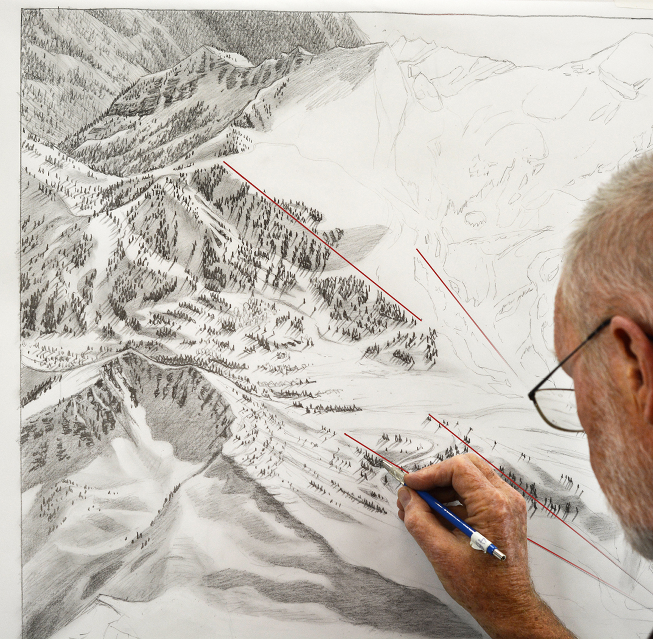
The painting process I continue to rely on for the best results is the same as Hal used two decades before me. The illustration board is coated with gesso so the watercolor will lay on the surface. This gives the color more vibrancy plus it allows the color to be lifted with water for future alterations as the ski resort expands.
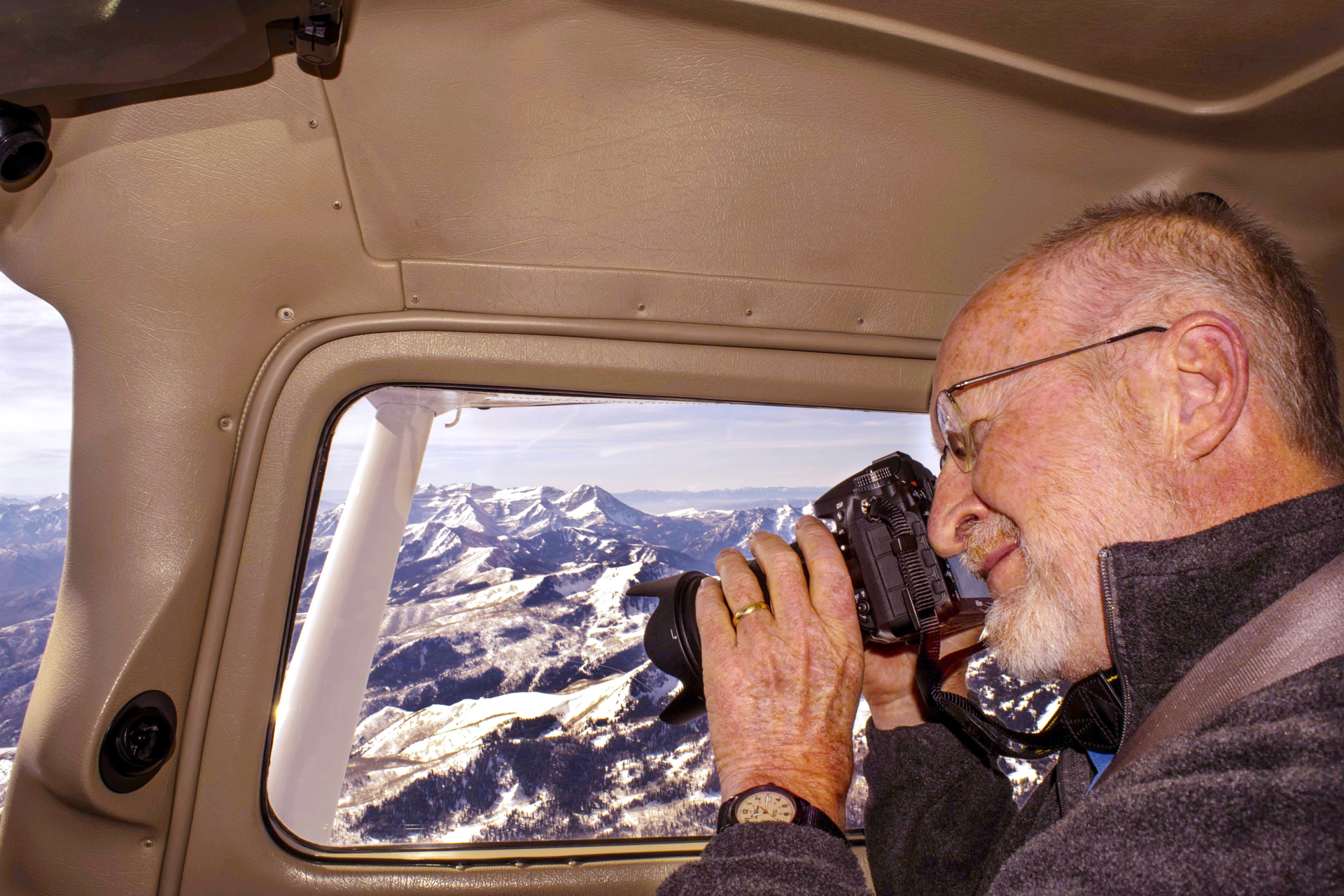
Aerial photography is vital reference material to portray the elements that make up the scene and trail system. Winter shots show distinction between conifers and deciduous trees, rocks and cliffs and the undulation, steepness and faces of the slopes. And there's the base facility, parking and on-mountain buildings to be photographed from above. The sketch is derived from all the aerials and any existing maps (today satellite imagery is helpful, though I manipulate it a great deal). Upon approval of the sketch it is transferred to the board by projection so every detail is retained exactly as the sketch. Then I will mask the horizon and airbrush the sky and the snow's surface. The tree shadows are next, followed by finishing the features (trees, rocks, cliffs, buildings, etc.) from the top to the bottom of the view. A proof is sent out and after alterations or approval the painting is sent to the photo lab for a hi-resolution capture. I then spend a considerable time enhancing color and cleaning up the scan.

Alta comes to life
What is the most memorable mountain you've painted?
I have painted 175 different resorts which really makes it impossible to pick a most memorable mountain. But I can tell you that my career has taken me to spots on this earth that, as a young adult, I never thought would be attainable. I have flown over some of the most dynamic and beautiful terrain to be found anywhere. Sometimes floating in perfect conditions such as around the Grand Teton so close I felt I could have jumped from the plane and survived in the deep powdery snow (obviously, don’t try this). The other extreme was while flying over Mont-Saint-Anne bouncing violently in the Cessna. It was so cold that the windows would frost over on the inside quickly after several shots. I scraped it free frequently with the only thing I could find, my credit card.
But these samples are memorable because of the flight. Other mountains it's because of the interesting people I worked with, the difficulty of the trail system or the many facets or bowls needed to be represented. Or, while sitting around a conference table with the staff discussing the best approach to the new trail map, a cougar strolls in through the open door. It was at Telluride and the cougar was followed by his master, but I was still very uncomfortable as the cougar just kept walking in…then went under the conference table. I was praying the cat could not detect my fear.
I get to travel, ski, fly, paint, meet interesting people…and have a few surprising twists thrown in!
What do you love most about the maps you create?
“The other extreme was while flying over Mont-Saint-Anne bouncing violently in the Cessna. It was so cold that the windows would frost over. I scraped it free with the only thing I could find, my credit card. ”
I feel that it is important to translate the distorted, exaggerated or manipulated map perspective to a “believable” image that is taken to be absolutely correct.
All elements including junctions, lengths, widths, elevations and steepness of trails must be correctly relative to each other to be interpreted by the skier as they navigate the slopes. Realistic detail is essential: each tree, glade, rock, cliff and slope undulation just adds to the credibility of the map.
I guess what I love most is that they are the one image that is truly unique to only the resort it represents. The ski map is the single most used resort image and is used for many years, so it's important to me to compose the very best perspective rendered to the very best of my skill since the result will be representing the resort and representing me.
What are some of your other passions?
At 70 I have retired…well, not quite. I am making alterations for existing clients and there are projects that I just can’t turn down. I missed the challenge last year when I had set aside three months to travel. I really love doing what I do and will continue to take on projects that interest me…for a few more years!
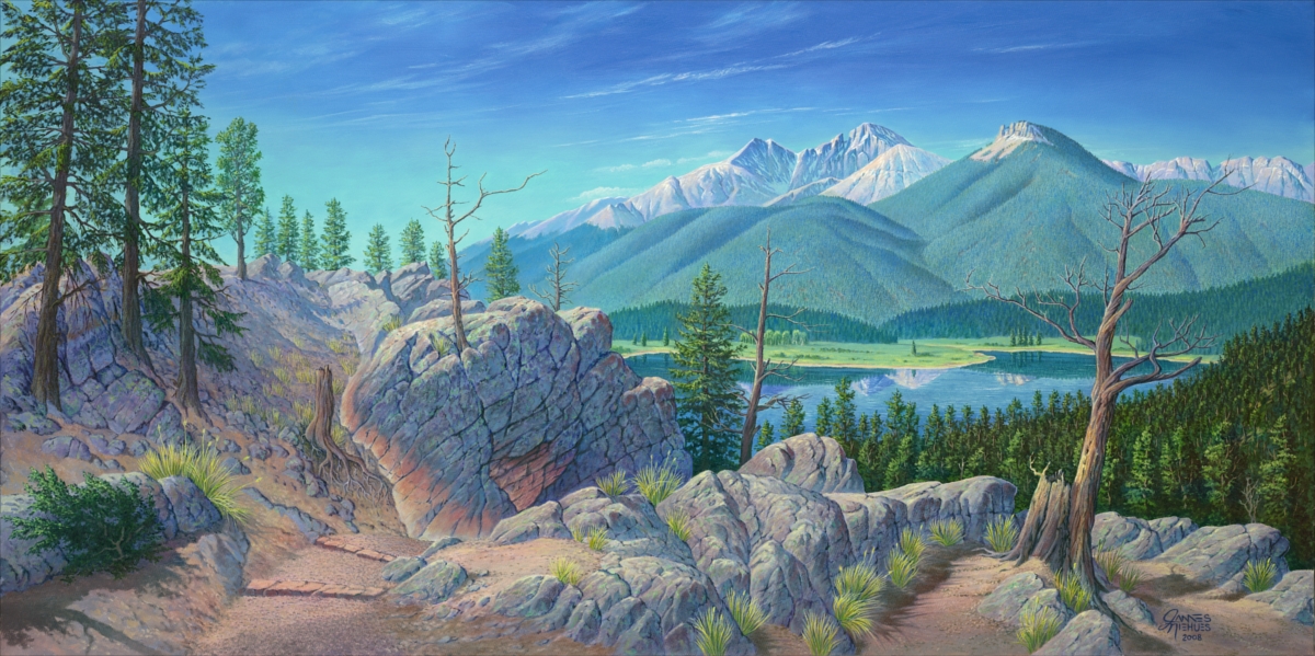
At an early age I wanted to be a landscape artist painting in oils. I have painted a few during my trail map career. As I visit these resorts I am constantly photographing scenes that I would love to paint in oil - I have hundreds of scenes in my computer just waiting to be put on canvas, but I know I can’t possibly paint them all. An interesting map project comes up and another landscape is put to the side. Perhaps in the next few years I will turn more to traveling with my wife, paint some oils and enjoy all the great scenery our country has to offer.
You can see more of Jim's maps and order prints from his website.